Day 1:
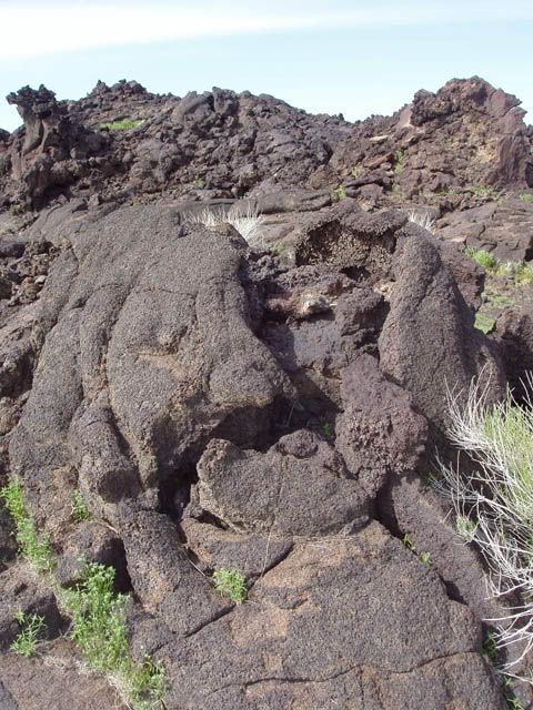
we left OC at 5 am, and drove up to 395. We stopped at a place called fossil falls. Geology time: It is hard to date this, but this event is probably pretty young, maybe 20,000 years ago, a very large basalt lava flow covered miles in the Owen's river valley. The river was blocked, temperarily forming a lake. The lake over flowed the basalt dam and made a waterfall, that cut through the lava, smoothing and polishing the basalt, and forming some pretty amazing pot holes where rocks got stuck in votexs.
So here are the stock photos:

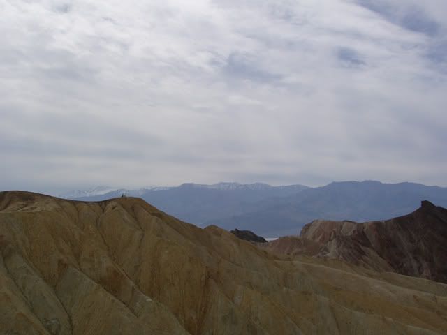
After that we went there we drove towards the ancient bristlecone forest in the White Inyo Mountains, past Lone Pine. More amazing stuff I didn’t get pictures of. But I found a fossil of the head of a trilobite, which was pretty cool. We made camp here. IMO, I would continue on 395 instead of taking this turn off, and stay the night in the Mammoth Lakes area. If you are a camper there is a lot of BML land to camp on, as well as real camp sites in places such as Mono Lake. For hotels, you can stay in Mammoth Lakes or Lee Vining.
Day 2:
We left from camp at 8am. We drove up to Convict Lake, where we hiked to Mildred Lake: 4 miles and 2,000 feet (up) away. You should be able to find Convict Lake on a map. If not, it is near Lee Vining and the Hot Springs. You should see a turn off. It will be on the left.
This hike is well worth the 8 hours it will take you. But it is NOT an easy hike. For you backpackers, there are actually two more lakes on the string of lakes. Many people backpack up and stay at one of the higher elevation lakes. I'd love to do this, but lugging all that stuff up 4,000 feet. Oi.
Geology time: Convict Lake is what is called a Tarn, this is a lake that forms where a glacier used to be, when the terminal moraine (the junk that the glacier carries down and dumps at the front of it) blocked the water, forming a permanent lake. We hiked up the lateral moraine (the junk left at the sides of the glacier) up to another glacier lake in a whole other valley. If you pay attention to land marks in the pictures, you can see how far we went.
Convict Lake


Alright, starting to go up:

More geology: the line of black is what we call a dyke this was basalt that was injected into the limestone (white rock) and then was metomophosized into what my professor called (I think) Greenstone. Which is gorgeous. I brought a piece back with me. I want to go up there with a dump truck and do my house in it. Both of these rocks are older than the Sierra Nevada granite, and this is one of the few places where you can see them. They are 300 million years old.

Alright, back to going up

Remember the mountain with the snow in the way back

Looking back, see that white ridge on the right hand side? That’s where the dyke is:

Color change due to uplift from faulting, the white is on top of the red above this picture:

This is a good place to stop for lunch, and contemplate how you will cross the river. The bridge was destroyed in an earthquake back in the late 80s. I highly suggest you continue on your hike, you will see why as you keep scrolling. As a side note, this made crossing the Virgin River look easy:

Looking back again, as before, see the ridge where the dyke is:

Sweet folded rocks:

Geology break: how did this happen? Well, the stripes are layers that were layed down successively. Then, they were pressed together under compression and folded, much like an accordian does. What you are left with is amazing.

Alright, remember that mountain? Welcome to Lake Mildred.


I’m sure it was cold:

One more look back from where we crossed the river:

As I said, you can keep going after Lake Mildred. If you want to do this either leave very early, or bring gear for camping. It took us about 6 hours to get to this lake, and the next lake isn't very close. Now, we were going at the pace of a lot of non-hikers. If you are used to high elevation hiking, you could probably do this much faster.
After that, we went to Hot Creek, but the hot springs were closed, fittingly enough, for geologic reasons. I suggest you drive over there to see if it is open. The dip would have been great after hiking all day. The area became active in June this year. The heat increased, more gasses started to escape, and a gyser started up. So much for that hot bath. So we went to camp at an Obsidian dome. Where it got really cold.
This was the weather for the closest town, and we were up in the mountains around it, so it was even colder. Bottles of water froze. Someone spilt coffee on the table in the morning… that froze too. This is why I suggest summer. Bring a good sleeping bag and pad if you go up in fall.

The next morning we hiked up the Obsidian dome.
Geology time: this was a small eruption from the whole Long Valley Caldara volcanic area. Pulses of explosive rhyolite (what granite is when formed above ground) and oozing obsidian (volcanic glass) and pumice( same as obsidian but with more gas in it, so instead of being glassy it is light and puffy. If the obsidian is the Guinness, the pumice is the head). As I said, this was a small explosion, considering the “big one” 760,000 years ago caused a crater 20 miles long and 10 miles wide.
The dome was mined, which gives you a very nice road to walk up. The rocks are pretty cool as well. If you aren't a rock person, you can skip this. If you aren't a BML land camper, you probably will skip this.

Another small crater, this didn’t cause the dome:

Oh so strong! This is pumice


Here is a good example of the pulses. The pink is rhyolite, the black is obsidian, in some places they are only centimeters apart, in others, feet.


Sunrise:

After we left camp and the dome we drove to Mono Lake.
Politics time: In 1941 (I think) LA started to drain Mono Lake as part of the LA Aqueduct system. The water level went down drastically, and at some point, a land bridge was formed from the shore to an island in the middle. Now on this island is where the California Gull lays its eggs. Coyotes were able to walk across to the island and eat the eggs, taking out 80% of the eggs. So LA was forced to stop taking the water, and they started to refill the lake. They are putting it back to 1963 levels. Sad thing is, a lot of the tufa towers will get covered. What’s tufa? Looks like we're due for some....
Geology time: within Mono Lake are tufa towers. These towers are formed when water filled with calcium, seeps through the bottom of the lake bed into water filled with carbonate (like soda). The two combine to form calcium carbonate, or limestone. The calcium filled water comes through in linear fissures in the bottom of the lake bed, fault related (I think). The salinity of the lake is greater then that of the sea, and it is very acidic, why LA wanted this water is beyond me, they could have gone down to Santa Monica and got it for a lot cheaper.
Okay, tufa time:


Everyone should see Mono Lake before they die. Get there quick before the towers are gone below the surface of the water. But don't feel too bad they are going, they were created under water, and that is where they belong.
After the lake, we did a quick stop close to Hot Creek where there is a geothermal plant. Basically, they drill holes and inject water down onto (or near) the magma chamber. The water is then super heated, turned into steam, which runs turbines and makes electricity. Renewable resource ftw! And that was geology time. So we went to see how hot it was.
This was about 18 inches into the ground

That’s about 178 degrees to those who are celsius impaired. We found as hot as 185 degrees. If you don't have these instruments, it doesn't make much sense to stop here. But I included this for warning. DON"T camp in geothermal areas! I know, they are inticing with their warm earth and clear grounds. But many a camper have fallen asleep on these grounds never to wake up again. Poisionous gasses aren't fun.
Instead of stopping at the plant, I suggest you go look at the crators up near Mammoth Lake. Those are a lot of fun.
After this, go home. I hope you enjoyed your weekend!